Evermotion: More Than an Asset Library
How Evermotion became a full-scale production partner for archviz, automotive and synthetic data.


Total: € 0
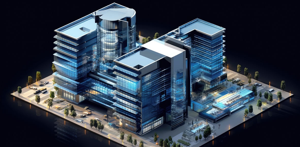

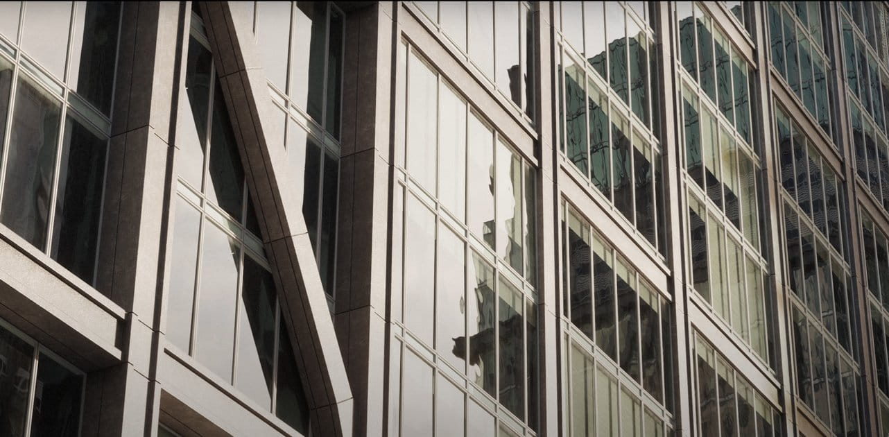
These digital tools allow for a more detailed, accurate, and efficient planning process, transforming how urban spaces are conceptualized. Evermotion provides a wide range of 3D models for various urban infrastructure projects.
The journey from an abstract concept to a fully realized urban infrastructure plan is complex and layered with numerous considerations. At the heart of this transformative process lies the power of 3D city infrastructure modeling. These dynamic 3D models serve not just as visual aids but as interactive platforms through which urban planners can navigate and manipulate the intricate web of urban design. By employing these models, the spatial dynamics of streets, buildings, public spaces and their interconnectivity come alive, allowing for an iterative design process that closely mirrors reality.
This ability to experiment with and visualize different design scenarios in a virtual environment is instrumental. Planners can predict the outcomes of various configurations, seeing firsthand how changes in one area might ripple through the urban fabric, affecting traffic flow, pedestrian pathways, and local ecosystems. Such insights are invaluable, ensuring that the final plans are innovative and deeply rooted in practicality. They bridge the gap between imaginative concepts and feasible, real-world applications, making the initial phase of urban infrastructure projects both creative and grounded.
In urban planning and construction, the margin for error is often slim, and the consequences of inaccuracies can be costly regarding resources and time. This is where the precision of 3D modeling for infrastructure becomes a game-changer. These models provide a detailed canvas, enabling planners to dissect every facet of an urban project with exactitude. From the alignment of sewage systems to the placement of lighting, every element can be meticulously planned and reviewed, minimizing the likelihood of unforeseen issues once construction commences.
This preemptive quality of 3D infrastructure models significantly streamlines the planning process. Projects can proceed smoothly by identifying and resolving potential problems in the virtual world and adhering closely to projected timelines and budgets. This transformative efficiency level allows urban planners to confidently undertake more ambitious projects. Moreover, this accuracy ensures that the infrastructure serves its intended purpose upon completion. It does so with an optimally allocated budget and timeframe, setting a new urban development project management standard.
The role of nature in urban environments cannot be overstated. It brings aesthetic value and contributes to city dwellers' ecological and psychological health. 3D models of plants and landscaped areas are pivotal in planning these green spaces with precision and creativity. Through the lens of 3D environment models, planners can explore various flora and open space configurations, balancing urban density with the need for natural retreats. This digital experimentation facilitates the design of green spaces that are not just visually appealing but functional, enhancing biodiversity, stormwater management, and recreational opportunities.
The thoughtful integration of these elements through 3D modeling ensures that urban landscapes can thrive amidst concrete and steel. It allows planners to simulate plantings' seasonal changes and growth patterns, ensuring that the green infrastructure is resilient and sustainable over time. Such meticulous planning fosters urban developments that look good on paper and promote the well-being of their inhabitants and the surrounding environment, making cities more livable and loveable.
The complexity of transforming urban spaces requires a symphony of expertise, with each stakeholder playing a crucial role. 3D models act as the conductor's baton, orchestrating seamless collaboration between architects, engineers, city planners, and other professionals. This shared digital language eliminates misunderstandings, aligns visions, and paves the way for a cohesive development process. The collaborative potential unlocked by 3D infrastructure models is fundamental in facing the multifaceted challenges of urban development, ensuring that every voice is heard and every expertise is leveraged towards achieving a unified goal.
Urban development is not just about the physical reshaping of cities; it's also about molding the social and cultural landscapes. Engaging the public in this process is crucial, and 3D models serve as the perfect medium for this dialogue. By presenting complex designs in an accessible and engaging format, these models invite community participation, making the intricacies of urban planning accessible to all. This engagement fosters a transparent decision-making process, where feedback from the community helps shape projects in a way that truly reflects the collective vision. The use of 3D environment models in public forums not only democratizes urban planning but also builds a bridge between the planners and the people, ensuring that the cities of tomorrow are built on the aspirations of today.
The path to urban development is navigated with a compass of regulatory standards, guiding projects toward compliance with legal and environmental mandates. 3D models are invaluable in this navigation, providing a detailed preview of how proposed infrastructures interact with their environments and regulatory frameworks. This preemptive insight allows planners to adjust designs proactively, ensuring that projects align with zoning laws, building codes, and sustainability criteria. The proactive stance afforded by 3D modeling accelerates the approval process and fortifies projects against potential legal and regulatory hurdles, securing a smoother journey from conception to realization.


LEAVE A COMMENT


|

|

|

|

|
 Customer zone
 Your orders
 Edit account
 Add project
 Liked projects
 View your artist profile
COMMENTS