Search
Cart
Your cart - 0 items
Total: € 0
Total: € 0
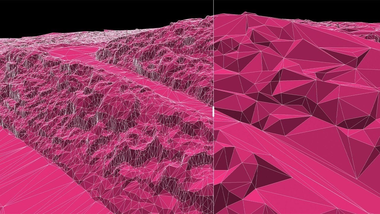

Mach9 has extended its web-based AI CAD software to process aerial LiDAR and photogrammetry datasets from drones, helicopters and aircraft, moving beyond ground-based scanning workflows. The expansion lets survey firms and visualization teams ingest aerial point clouds directly into the platform, automate feature extraction, and export site-ready geometry to standard CAD formats in a fraction of the time traditional methods require.
The software automatically identifies kerbs, building footprints, pavement edges, vegetation outlines and utility poles from aerial data with centimetre-level accuracy. It also extracts 3D catenary geometry from suspended power lines, useful for clearance analysis and pole loading work. Mach9 pairs AI-driven point cloud classification with manual editing tools, allowing users to refine results before delivery. A deviation heatmap tool visualizes high and low points in surfaces to flag areas needing refinement.
According to Langan, a survey firm working on projects covering several thousand acres in Texas, the platform has delivered around 40% reduction in delivery time. Russ Hall, Senior Survey Project Manager at Langan, noted:
Now with [Mach9], we're able to build the surface natively inside, check the surface against the point cloud and the extraction, and then export out a LandXML that draws correctly in Civil 3D or OpenRoads.
Welch Comer reports average savings of four to five hours per project, according to Thomas Tucker, Survey Project Manager there. That pace means, as Tucker put it,
Anytime we can save time, that allows time for another project. I've seen an average savings of four to five hours per project. [Every] two projects, we're saving a day.
Mach9 exports data to DXF, DWG, LandXML and GIS formats (SHP and GDB). The software works with aerial systems from RIEGL, Leica, Trimble, GeoCue, Phoenix LIDAR, YellowScan, Wingtra, Teledyne Geospatial and DJI, with additional support for Skydio, LiDARUSA, Emesent and Inertial Labs according to some sources.
For archviz artists handling site-based projects with surveyed terrain and existing buildings, aerial point cloud processing that cuts weeks from the survey-to-usable-model phase shortens a key bottleneck. Mach9's automated extraction of site features and direct export to DXF, DWG and LandXML means point clouds arrive ready to import into your scene layout rather than requiring days of manual cleanup and modelling.
The time savings compound on large sites. Where traditional ground scanning forces crews to return to site if a feature was missed, automated aerial processing can regenerate results in hours with a few clicks. That reduces client change requests from becoming remobilization work, and lets survey teams deliver more detail per project. For studios managing the data-preparation phase before building and rendering, faster and more accurate site geometry from aerial sources means more time spent on visualization quality and less on geometry cleanup.
Lead image: AEC Magazine








LEAVE A COMMENT







|

|

|

|

|
 Customer zone
 Your orders
 Edit account
 Add project
 Liked projects
 View your artist profile

COMMENTS